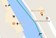
The guides are based on Google Maps.

So that you can try BoatSatNav out, we have created a sample guide which contains part of the Grand Union canal, from Norton junction down to Cosgrove.
In order to access the guide you need to go through the same process as when you subscribe so that you can be 100% sure the guides will work on your device(s) before you join. Tablets with GPS offer the best experience and most functionality but the guides also work on mobile phones as well as laptop or desktop computers through a browser.
Google Maps for Android devices
All you need here is a web browser. You will be able to access the guides in one of two ways:
UK WATERWAYS MAP
See the UK and all of it's waterways at a glance. Zoom and drag the map to access further detailsINDIVIDUAL GUIDES
A text list of the individual waterways, simply click on the one you wish to viewRegardless of the device you use you will also need a free Google account.
If you don't already have one, use the link below to sign up and make a note of your new .gmail address